


About the park

Our website relies on donations and affiliate links. If you click a link taking you to another website, and make a purchase, we may gain a small commission - at absolutely no cost to you. This helps us expand the website, so we can continue doing what we love!
300 million years ago, a sea covering the Colorado Plateau evaporated, leaving behind salt and rock. This salt was compressed by debris from floods and winds, making it unstable and forcing it through long strips of rock creating large cracks. Water, ice and wind has then worn away at these cracks for millions of years to form over 2000 natural sandstone arches. Nowhere else in the world can you find more arches in such a small area.
Amongst the arches are numerous geological features sculpted by time, with buttes, pinnacles, spires and balanced rocks all making up this dramatic landscape in front of the La Sal Mountains. The sandy desert soil is teeming with life that is delicately establishing itself from a basis of cyanobacteria, lichen and fungi. It is therefore extremely important that visitors stay on the designated paths in order to protect the biodiversity of the park. Hikes in the summer are challenging due to the immense heat, often reaching over 100F, but in the months either side, the park presents plenty of opportunities to appreciate the unique setting. In winter, snow is frequently scattered across the various sandstone structures to beautifully change their appearance.
The main sights and hikes of Arches NP are spread out widely, but many can be seen by travelling along Main Park Road which extends up to the Devil's Garden trailhead, one of the most northern parts of the park. This naturally makes Arches feel like a busy park throughout most of the year, and especially during peak season in summer. Consider coming around the change of the seasons to really appreciate the majesty of what nature has created. And don't forget with its close proximity to Utah's other fantastic National Parks, that a road trip that encompasses all of them might be the best way to spend a vacation!
Can't miss
Delicate Arch
One of the most famous arches in the world, this 52ft tall arch can be viewed from afar at Delicate Arch viewpoint, or up close. Watching the colours of the sky change behind the arch at sunset is a popular way of appreciating this iconic landmark - just remember your head-torch for the hike back! Arches is a recognised Dark-Sky park after all...!

Park Avenue
One of the first possible stops on the drive into the park, this series of towers and walls soar over 600ft tall. Park up and look from the viewpoint, or head into the canyon on a 2 mile round trip hike to see the layers of these sandstone wonders, and appreciate the physical power that has created them.

4 x 4 Adventure Tour
Arches is becoming an increasingly popular and busy park, so perhaps the best way to view it is off road! Feel the ruggedness of the terrain as you tour around Arches and see some of the more remote places in the park in this guided tour.

Explore the park

Click to expand


Points of interest
Top experiences
Trails
As ever, we recommend conducting some of your own research on hikes as well as talking to park rangers in order to find less populated trails that may be of interest, helping to prevent overcrowding and erosion of the park's best known routes. But here are a few suggestions to consider to get you started...

Gentle
The Windows
The Windows Trailhead
Length (roundtrip): 1.2 miles
Approximate duration: 30-45 mins
Maximum elevation: 5325 ft
Max-Min elevation change: 160 ft
A classic way of viewing some of the most famous arches in the park. Whilst viewable from the road, the scale of these particular arches are some of the most impressive in the park because of how close you can get to them!
Park up off Windows Road, which junctions off of the main road through the park just after Balanced Rock (a quick stop here never hurts!). Then head south along The Windows trail on a loop that lets you see Turret Arch, North Window Arch and South Window Arch. It is only a small rise in elevation from the car park which should be easily manageable for most visitors! Just don't forget that even on short hikes in Arches during the summer months, you'll still get extremely hot, so remember the water and to apply sunblock!
For those looking to hike a little further without having to get back into the car, then cross over the road and make the short trip to appreciate Double Arch up close.

Moderate
Delicate Arch
Delicate Arch Trailhead
Length (roundtrip): 3.0 miles
Approximate duration: 2-3 hours
Maximum elevation: 4875 ft
Max-Min elevation change: 480 ft
The most famous arch in the park and one of the most famous in the world, Delicate Arch is beautifully placed in the foreground of views out over the La Sal Mountains.
Parking up at the Delicate Arch trailhead at Wolfe Ranch, hike over ridges which gradually ascends you to a view of the arch through Twisted Doughnut Arch. Carry on just slightly further and you'll arrive at the panhole in front of Delicate Arch. This is where the majority of photographers sit to capture the arch during sunrise and sunset. Delicate Arch is probably the most popular hike in the park and is very busy throughout the year, and at all times of the day. While still a great hike, don't expect to be able to capture the tranquil shots like you often seen online!
For those that would like to see the arch but don't want to hike the 3 miles, consider the shorter Upper Delicate Arch Viewpoint hike of around 1 mile. It is quite small in the distance from here, but still very beautiful.

Demanding
Devils Garden Loop
Devils Garden Trailhead
Length (roundtrip): 7.9 miles
Approximate duration: 3-4 hours
Maximum elevation: 5530 ft
Max-Min elevation change: 500 ft
The Devils Garden Primitive Loop is the longest and most difficult hike in the park. The length of this hike in the hostile conditions of the park means it should only be attempted by those prepared and relatively experienced at hiking, especially in the summer.
Some rock scrambling spices up the trail as you circle out to Double O Arch, which can be done clockwise or counterclockwise - the latter has some more steep sections which may be easier to slide down if hiked clockwise. One of the main draws of this hike is Landscape Arch, the longest arch in America, which always looks stunning against the clear blue skies that Utah often experiences.
There are also some slightly higher sections and offshoots to Private Arch, Dark Angel and Partition Arch. Consider doing all of them to really appreciate everything about this trail!
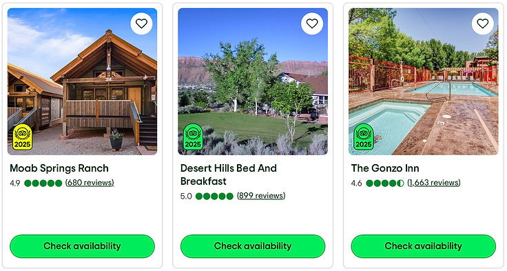
Where to stay
Hotel
picks
Rental
options

Campsite
choices
When to visit
We recommend: Apr-May or Sept-Oct, as temperatures in the 70's and 80's allow for more hiking and exploration
Itineraries


